Solutions · Public Safety
geoBingAn
EveryThings about maps. Customize, collect, visualize — a LINE / WhatsApp-native platform for disaster coordination.
geoBingAn's full product, subscription plans, API documentation, and the Console / DataHub common operational picture all run at v2.geobingan.info. This page is an overview.
Your town, your safety map
Transform local knowledge into interactive emergency maps that guide neighbors to safety.

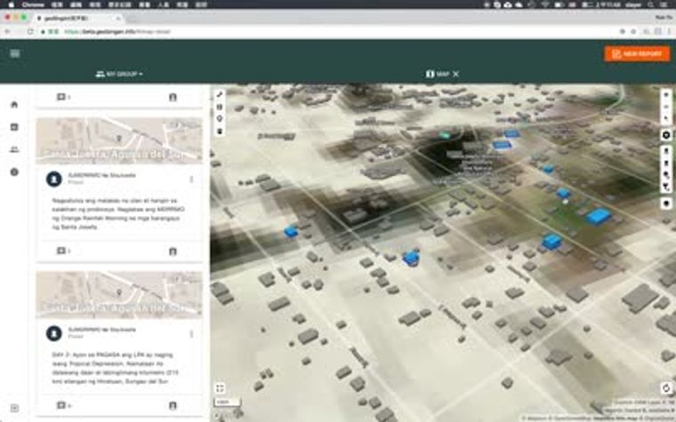
The map for your team
Collaborate on data collection and mapping — turn scattered entries into shared insight.
Resource management
Stop losing track of supplies. Forms make resource management click-simple.

Standards-native
GeoJSONCAPEDXLHXL4W / OCHAOGCLINEWhatsApp